AI Map Generator: From Worldbuilding Notes to a Usable Fantasy Map Draft
A fantasy map needs more than convincing mountains and rivers. Use a fictional river-crossing scenario to turn worldbuilding notes into visual constraints, then check names, routes, distances, and what players should see.
·
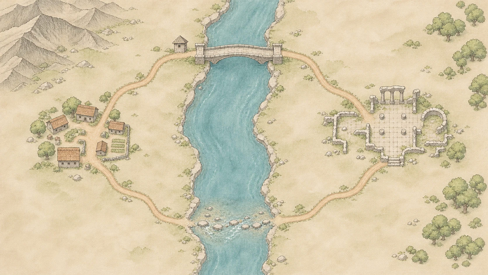
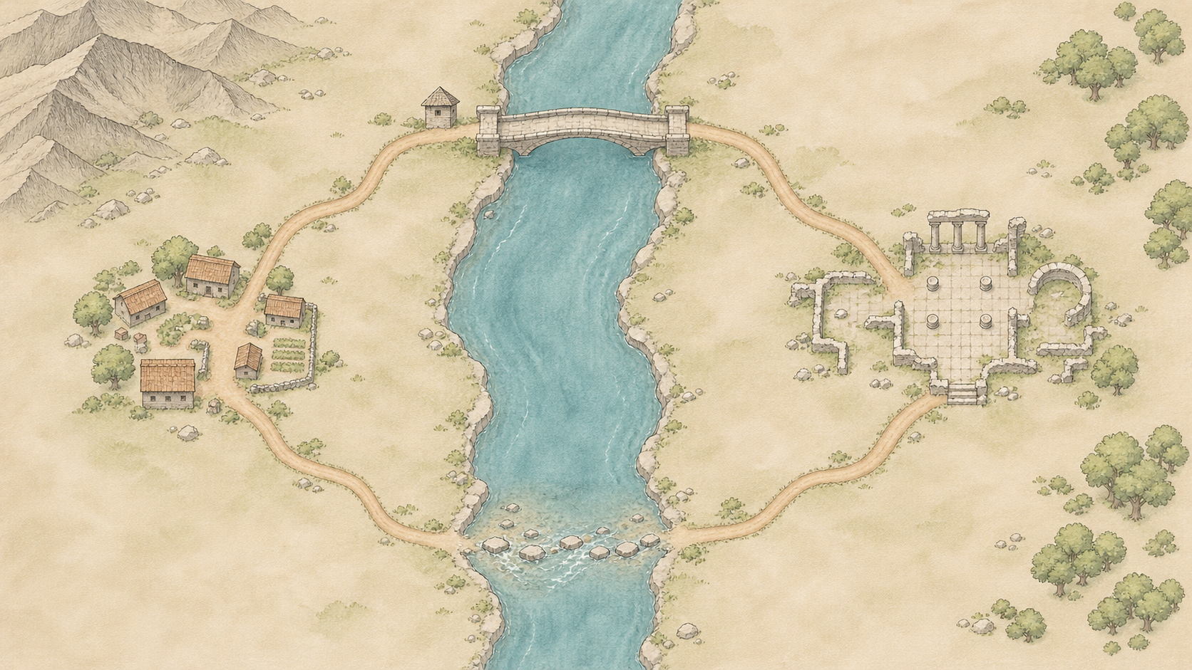
The party needs to reach a ruin across the river. Guards control the northern bridge; heavy rain closes the southern ford. If the map merges those routes into one, beautiful terrain will not restore the missing choice.
For game masters and worldbuilders, an AI map generator is best treated as a way to develop a visual draft. Whether that draft works for a session depends on checking the relationships that matter to play. This is about fictional maps, not real-world geography, navigation, or precision cartography. The river crossing below is an illustrative design exercise, not a tested project.
Give the map a decision to support
Keep this example local: a village on the west bank, a ruin on the east bank, a guarded stone bridge to the north, and a ford to the south that becomes impassable after heavy rain. There is no third crossing between them.
That scope supports travel decisions. It does not automatically produce a tactical battle map. If the session requires exact movement, weapon ranges, or positions around a doorway, prepare a separate local map suited to your rules rather than repeatedly enlarging a regional illustration.
OpenArt’s DnD map page recommends considering the setting, key landmarks, and map scope when writing prompts. For this scenario, turn those broad categories into relationships you can inspect—not merely “include a bridge, river, and ruin,” but why each must be where it is.
| Setting element | Constraint in this example | What an error would change |
|---|---|---|
| River and banks | The river runs north to south; the village is west of it and the ruin east | Whether a crossing is necessary |
| Northern bridge | North of both destinations, with roads reaching both ends | Whether the guarded route actually works |
| Southern ford | South of both destinations; impassable after heavy rain | Whether weather changes the available choices |
| Roads | Connect the village, crossings, and ruin without another crossing | Whether an accidental shortcut bypasses the scenario |
Add terrain detail without overturning those constraints. If the setting includes a waterfall, underground river, or magical flow, document that exception rather than quietly changing the geography during revision.
Ask for an image, not a replacement for your setting notes
Keep a short written specification separate from the image prompt. The specification remains the reference; the generated picture does not become the authority on the world.
This prompt is a starting point for the example, not a promise that any model will follow every instruction:
> Fantasy regional map, overhead plan-like composition, north at the top. A river flows from north to south. A village stands on the west bank and ancient ruins on the east bank. A stone bridge lies north of both locations, and a ford lies south of them. Roads connect each crossing to the village and ruins; include no additional bridges or river-crossing roads. Mountains occupy the northwest and forest the east. Clear terrain boundaries and readable roads, minimal decorative obstruction. No place-name text, scale bar, or battle grid. Leave room for labels to be added later.
Requesting no place-name text keeps spelling management in a separate, manually controlled step; it does not guarantee that the image will contain no lettering. Crossing count, road connections, and orientation also need inspection. Consider leaving out a scale bar until the layout is stable: precise-looking markings can imply more reliability than the draft deserves.
To make a first visual draft, you can enter a prompt and select a configured model in InkRoom’s image generation workspace. Available models, parameters, and fees depend on the current interface and account configuration. This entry point does not guarantee correct routes, labels, or scale.
Walk the routes before judging the artwork
Trace the northern route from village to ruin, then trace the southern route. Does the road reach the bridge entrance? Does the bridge span the same river? Does forest texture obscure a connection? Has the image introduced a route that avoids crossing altogether? These affect the session more directly than parchment texture or an ornate border.
Check distance along the intended road, not just the straight line between landmarks. For example, if you assign the bridge route a length of 6 kilometres and assume a travel speed of 3 kilometres per hour, the base travel time is 6 ÷ 3 = 2 hours, excluding stops, combat, and terrain adjustments. That is a calculation from stated design assumptions—not a measurement from the generated image or a universal game rule. If the illustration cannot reliably carry scale, record distances in the game master’s notes instead of inferring them from a scale bar.
Add names from one master list, checking both spelling and the location each label identifies. Separate player-facing information from game-master information. Players may need to see the bridge and ford without seeing a hidden ambush marked beside them. The ford’s current weather-related status can also stay in session notes rather than being permanently drawn into the base map.
Then revise the image: remove unintended shortcuts, fix connections, and reduce obstructions. Trace both routes again after changes. While the picture contradicts the written setting, it remains a draft. It becomes usable for this scene when its locations, names, and routes support the choices the session actually needs.
Related articles and cases
- AI Diagram Generator: From Source Notes to Verifiable Structure
Turn source material into nodes, relationships, and traceable references before generating a diagram. A clearly fictional example shows how to preserve unknowns, review branches, and choose an editable handoff or an API workflow.
- AI Tattoo Design Generator: Turn an Idea Into an Artist Brief
Use AI to make your tattoo idea easier to discuss, not to declare it ready to tattoo. A hypothetical brief shows how to describe placement, size, and line preferences, then review the concept with a professional tattoo artist.
- AI Pixel Art Generator: From Style References to a Consistent Grid
A retro-looking image is not automatically a usable sprite. Define the intended use, logical grid, and limited palette, then explore silhouettes and check scaling, transparency, and frame consistency before delivery.
- AI Logo Generator: From Brand Brief to a Usable Mark
Turn a brand brief into comparable logo concepts, then review actual-size legibility, monochrome use, backgrounds, spelling, rights, and delivery files before adopting a design.